
Summary
Despite this past weekend’s chill and light snowfall across the state, March is still running 3-5°F above the long-term average (1991-2020). Our active weather pattern continues as well. We have seen the bulk of the precipitation shift a bit northward, with the heaviest precipitation over the last two weeks falling across northwestern counties (Figure 1). A scan of observations shows daily average 2” and 4” soil temperatures running in the low to mid 30s across the north to the low to mid 40s across southern counties, soil moisture running in the 80th percentile and above, and most rivers and streams at or above historical stream flows for this time of year. For the latest up-to-date conditions, seasonal outlooks, and monthly climate summaries, please visit the State Climate Office of Ohio.

|
Figure 1). Accumulated precipitation for March 15-28, 2022. Figure courtesy of the Midwestern Regional Climate Center (https://mrcc.purdue.edu/). |

|
Figure 2). Precipitation forecast from the Weather Prediction Center for 8pm Monday March 28 – 8pm Monday April 4. |
Forecast: Northwesterly flow will keep chilly temperatures and few scattered snow showers in the state for Tuesday. A warm front will push northward Tuesday night and Wednesday. Southerly winds in the 30-mph range will push highs into the 60s and 70s on Wednesday. With low humidity and breezy conditions, there will be an elevated fire danger across the southeast. Showers are likely Wednesday and Thursday as temperatures fall back closer to normal values. Sunshine returns for Friday and Saturday with highs in the 40s and 50s. Another round of showers could move in on Sunday. Overall, the Weather Prediction Center is currently forecasting 0.10-0.50” inch of liquid-equivalent precipitation over the next 7 days (Figure 2), a bit below average for this time of year.
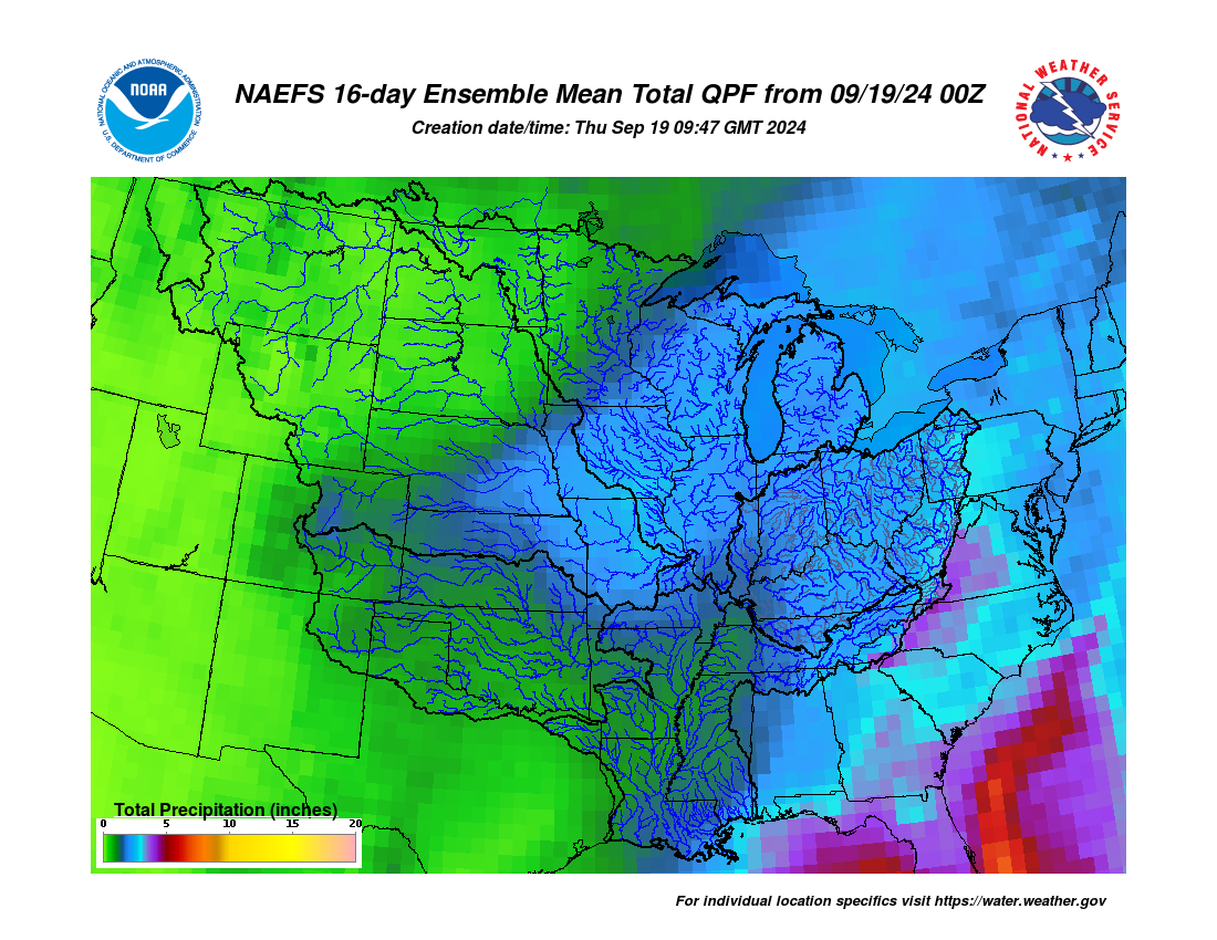
The Climate Prediction Center’s 6–10-day outlook for the period of April 3 – 7, 2022 and the 16-Day Rainfall Outlook from NOAA/NWS/Ohio River Forecast Center indicate that temperatures are leaning below average for the period with near to drier than average conditions as well (Figure 3). Climate averages for this period include a high temperature range of 52-59°F, a low temperature range of 34-38°F, and average weekly liquid-equivalent precipitation of 0.55-1.0 inch.

|
Figure 3) Climate Prediction Center 6-10 Day Outlook valid for April 3-7, 2022, for left) temperatures and right) precipitation. Colors represent the probability of below, normal, or above normal conditions. |